— Article
Hazmat Drones: Sensing the Hot Zone From a Safe Standoff
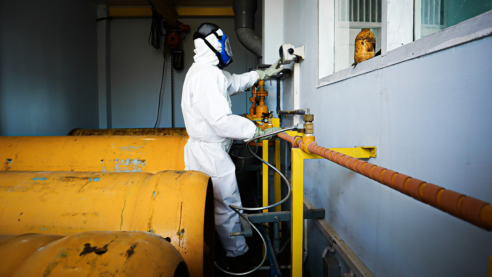
When a tanker ruptures, a rail car vents, or a refrigeration line fails inside a warehouse, the first and most consequential decision an incident commander makes is a question of distance: how far back do people need to stand, and who has to go forward to find out what is actually leaking? For most of the modern history of hazardous materials response, answering that question meant sending a human being, encased in a fully sealed suit, breathing from a tank with a half-hour of air, on a long, blind walk toward a container nobody could yet identify. Small unmanned aircraft have quietly rewritten that calculus. The drone now makes the walk first.
This shift is more than a gadget story. It represents a structural change in how the “hot zone” is conceived. By projecting cameras, thermal sensors, and increasingly sophisticated chemical detectors into a hazard while keeping the operator at a federally recommended standoff, drones decouple intelligence-gathering from physical exposure. The data still arrives; the responder no longer has to be standing in the plume to collect it.
The geometry of a hazmat scene
Every hazmat incident is organized around three concentric perimeters. The cold zone is where command, staging, and clean operations take place. The warm zone holds the decontamination corridor. The hot zone is the area of active contamination, the place no one enters without a reason and a plan. Drones do not erase these boundaries so much as let commanders reach across them.
How far those boundaries should sit is not improvised. The U.S. Department of Transportation’s Emergency Response Guidebook (ERG), the dog-eared orange book in nearly every fire apparatus in North America, prescribes initial isolation distances by material and scenario. For a spill or leak of an unidentified substance, the ERG’s standing instruction is to isolate the area for at least 100 meters (330 feet) in every direction as an immediate precaution. When a tank, rail car, or highway cargo tank is involved in a fire, the guidance escalates dramatically: for many flammable gases, responders are told to isolate and consider evacuating 1,600 meters (a full mile) in all directions, and to fight the fire, if at all, with unmanned monitor nozzles from the maximum possible distance.
A mile is an enormous gap to assess with binoculars. It is precisely this gap that drones are built to span. The aircraft can hold the human operator back at the ERG-mandated distance in the cold zone while pushing optical, thermal, and chemical sensing directly into the hot zone, preserving the standoff without sacrificing the picture.
The incident that proved the concept
If one event turned aerial hazmat reconnaissance from a theory into accepted practice, it was a leak in a Florida warehouse in November 2019. An anhydrous ammonia release (the chemical is toxic, volatile, and can blind and burn) triggered a chemical alarm at a food distribution facility in Sarasota County. Anhydrous ammonia is widely used in industrial refrigeration, and crews quickly established that it was venting somewhere onto the building’s roof. From inside, they could not pin down where.
Southern Manatee Fire & Rescue (SMFR) was called in for mutual aid and put a thermal-equipped DJI drone into the air. Flying over the roof, the aircraft’s thermal camera located the source of an invisible leak that would otherwise have required a suited team to climb up and search by hand. Rich Gatanis, the agency’s UAS coordinator, summarized the payoff in terms that have since been repeated across the fire service: the drone, he said, cut out the first hour by establishing within roughly fifteen minutes what was actually happening. A reconnaissance task that traditionally meant suiting a team into encapsulated protective gear and sending them up onto a roof was compressed into a single short flight, with no human exposure to the immediately dangerous atmosphere.
SMFR did not stop at looking. The agency went on to rig chemical and radiation meters to its aircraft, experiment with delivering hand tools to forward staging areas so crews would not have to trudge back hundreds of yards for equipment, and, critically, develop a field process for washing down contaminated drones so a hot-zone aircraft could be safely returned to service. The department has publicly estimated that the technology shaves one to two hours off a major response while reducing the burn-through of expensive single-use protective suits.
The deeper logic becomes clear when you count the minutes inside a suit. A self-contained breathing apparatus typically provides on the order of thirty minutes of air. On a sprawling scene, a technician may spend ten minutes walking out to the hot zone, has only about ten minutes of genuine working time, and must reserve the final stretch to walk back to decontamination before the air runs low. If a drone has already located the leak and even pre-positioned the right tool, the human team’s productive time inside the danger area is effectively multiplied. The drone is not replacing the responder; it is making the responder’s scarce minutes count.
What the drone can actually sense
The earliest public-safety drones were essentially flying cameras. The current generation is closer to a flying instrument rack, and the choice of payload is what determines how useful the aircraft is at a chemical scene.
The most safety-critical payload is the combustible-gas sensor that reads the Lower Explosive Limit (LEL), the concentration at which an atmosphere will support combustion. The threshold matters enormously: an atmosphere at 10 percent of the LEL is the conventional trigger point for treating the environment as immediately dangerous to life or health and enforcing maximum evacuation distances. A drone carrying a combustible-gas sensor can establish whether an atmosphere is approaching that line before any human walks into it. One operational caveat travels with these sensors: because they are usually calibrated against a reference gas such as methane, operators must apply correction factors to read other gases, gasoline vapor or hydrogen, for instance, accurately.
A second class of payload is optical gas imaging (OGI), an infrared camera tuned to the wavelengths where hydrocarbon gases such as methane, propane, and butane absorb energy. To an OGI camera, an otherwise invisible vapor cloud appears as a smoky plume, though the effect depends on the temperature contrast between the gas and its background.
At the far end of the spectrum sit standoff spectroscopy payloads, laser-based and infrared systems that read a chemical’s signature from a distance without the aircraft ever entering the cloud. Deep-ultraviolet standoff Raman sensors have been demonstrated identifying explosives and toxic industrial chemicals at ranges measured in kilometers, and differential-absorption and open-path infrared systems can return path-integrated concentrations of a gas along a line of sight. These are the tools that let a drone read a plume it never touches.
Getting the picture home
Sensing a hazard is worthless if the reading never reaches the commander standing a mile back, and that link is harder to hold than it sounds. The consumer-grade 2.4 and 5.8 GHz radio links most drones ship with degrade fast amid the steel tanks, dense piping, and reinforced walls of an industrial site, and they were never built to span a long standoff in the first place. Serious programs increasingly route command, control, and sensor data over cellular LTE and 5G networks instead, the same connectivity the proposed Part 108 framework leans on for remote operations, so that telemetry and live payload feeds reach the command post regardless of what is blocking line of sight.
Just as important is the ground control station (GCS) software that has to ingest and display all of it in real time. A thermal video feed is the easy part; a stream of custom gas-concentration or radiation values from a bolted-on sensor is not, because it has to be parsed, time-stamped, and overlaid onto the same map the commander is reading. On open-source and custom-built airframes that payload data typically travels over the MAVLink protocol, a common language that lets a third-party sensor talk to both the flight controller and the GCS. The dominant DJI aircraft, by contrast, run a closed ecosystem and proprietary software development kit, which is part of why agencies that need exotic sensors so often end up either engineering their own integrations or buying purpose-built industrial platforms. The data link, in short, is as much a part of the standoff architecture as the airframe itself.
The rotor-wash problem nobody can wish away
There is a genuine physical contradiction at the heart of drone air sampling, and it deserves to be stated plainly rather than glossed over. A multirotor stays aloft by throwing a large volume of air downward. When such an aircraft hovers directly over a spill to sniff the atmosphere, its own propellers stir, dilute, and flatten the very concentration field the onboard sensor is trying to measure. Peer-reviewed studies of quadrotor airflow have documented exactly this effect: the drone’s wake can distort gas readings, and a commander who trusts an artificially low number is being handed a false sense of security.
The mitigations are real but partial. One approach lowers the sensor on a tether, dangling it well below the rotor wash and ground effect so it samples relatively undisturbed air. That fix carries its own hardware penalty: a sensor swinging on a line shifts the aircraft’s center of gravity and behaves like a pendulum, and without flight-control software tuned to absorb that moving mass, the resulting oscillation can build into its own hazard directly over the spill. Another approach sidesteps the problem entirely by using standoff optical methods that read the plume from outside its turbulent boundary. None of this makes the contradiction disappear; it makes it manageable, and it is a reason serious programs treat a single drone gas reading as one input rather than gospel.
Why a drone in an explosive atmosphere is harder than it sounds
A chemical scene full of flammable vapor is, by definition, a place where an electrical spark can be catastrophic. Ordinary drones are bristling with potential ignition sources: brushless motors, electronic speed controllers, lithium batteries prone to thermal runaway, and the static charge a spinning aircraft can accumulate. Flying standard hardware into a verified explosive atmosphere is, candidly, a gamble.
The engineered answer is an intrinsically safe drone, one designed so that its circuits cannot release enough electrical or thermal energy to ignite a specific hazardous mixture, even under fault conditions, by holding currents and surface temperatures below defined limits. This is distinct from an explosion-proof philosophy, which tries to contain an internal ignition within a sealed housing. For a drone, the explosion-proof route is close to a paradox: sealing high-output motors inside heavy housings traps the very heat that continuous flight generates, while adding weight the aircraft can ill afford. Controlling energy at the circuit level is the only viable path for true close-proximity operation. That constraint does not stop at the airframe. Every electrical payload bolted on, an optical gas imager, a custom chemical sniffer, has to meet the same low-energy limits for the certification to remain valid, which is why dropping an off-the-shelf sensor onto a certified drone is far harder than it sounds and why integrated hazardous-area systems are sold as a tested whole rather than as parts.
It is also expensive and, at the moment, surprisingly hard to actually buy. Certified intrinsically safe multirotors are rare; the handful marketed for hazardous-area work run into five and even six figures, with one widely cited industrial model listed in the range of roughly $180,000, and even that aircraft’s hazardous-area certification has at points been described by its own vendor as still pending. The practical consequence is that most municipal fire departments cannot and do not buy these platforms. Instead they practice what the trade calls operational risk management: flying standard, far cheaper commercial drones at altitude, staying upwind, leaning on high-powered zoom and thermal optics, and reading threats from the periphery rather than from inside the highest-concentration zone where ignition is a danger. Those workaday aircraft are also, more often than not, made by DJI, which adds a second layer of friction: federal limits on buying Chinese-built drones with government money push some agencies toward costlier domestic platforms such as Skydio even where the imported hardware outperforms them. It is a workaround born of economics and politics as much as doctrine, and it shapes how the technology is really used.
Bringing the aircraft home without spreading the contamination
A drone that flies into a plume comes back dirty, and a contaminated aircraft returning to the cold zone is a cross-contamination hazard to everyone there. Yet the obvious cleaning agents, bleach, harsh solvents, even prolonged water exposure, can corrode the delicate gimbals, optics, and electronics that make the drone worth its price.
The solution adopted by a number of agencies is Dahlgren Decon, a decontamination chemistry developed at the U.S. Navy’s Naval Surface Warfare Center Dahlgren Division and commercialized by First Line Technology under a Navy licensing agreement. It is a three-component formula mixed on site, built to neutralize a broad spectrum of threats: chemical and biological warfare agents, toxic industrial materials, and synthetic opioids such as fentanyl and carfentanil among them. It is described as non-corrosive and remains effective for several hours after mixing, which makes it well suited to the careful, field-expedient washdown of a high-value aircraft. First Line Technology’s own marketing for the approach has carried a slogan that doubles as a thesis statement for this entire field: “Save a HazMat Team. Send a Drone.”
From a single picture to a working model of the scene
Sensing the air is only half the value. Drones have also collapsed the time it takes to document and model an incident. Where a suited team once had to physically measure a spill’s extent and photograph container orientations by hand, videogrammetry software can now turn ordinary drone video, shot from a safe, upwind standoff, into a georeferenced three-dimensional model of the site in roughly the time it takes to fly a short orbit. Those models reveal tank orientations, drainage paths, and spill volumes with real precision, and the resulting point-cloud data can be fed into atmospheric tools so that a dispersion estimate reflects the actual terrain of the site rather than a flat mathematical plane.
That feeds the other major use of drone data: plume modeling. Software suites such as ALOHA and HYSPLIT, maintained with involvement from the National Oceanic and Atmospheric Administration, predict how a toxic cloud will travel. Their traditional weakness is that they ingest coarse, regional weather data that cannot capture the micro-scale wind shifts at a specific intersection or rail yard. A drone hovering in the lowest layer of the atmosphere becomes, in effect, a mobile weather station, feeding live local wind, temperature, and humidity readings into the model so the projected footprint can be adjusted as conditions change. The payoff is concrete: SMFR has recounted using drone-derived plume awareness during a large warehouse fire to determine that smoke was drifting toward a school, then calling the school within minutes to shelter the children in place.
The regulatory knot: how far can the pilot really stand back?
Here lies the field’s central unresolved tension, and it is worth getting the current state of the law exactly right.
The foundation is FAA Part 107, finalized in 2016, which legitimized routine commercial and public-safety flights of drones under 55 pounds. Notably, Part 107 does not impose rigid numerical standoff distances from people; it places the responsibility on the remote pilot to judge a safe operation given the aircraft’s speed, trajectory, and surroundings. That performance-based flexibility is what lets agencies fly in chaotic disaster conditions without breaking federal law.
But Part 107 also requires the pilot to keep the aircraft within visual line of sight (VLOS) at all times. This produces the contradiction at the heart of large-scale chemical response: to keep eyes on the drone, the pilot has to stay relatively close to the hazard, partially undoing the standoff the drone is supposed to deliver. The catastrophic February 2023 train derailment in East Palestine, Ohio, where the release of vinyl chloride and other chemicals produced a plume stretching for miles, made the limitation impossible to ignore and accelerated calls for change.
The proposed fix is a new framework, Part 108, for routine beyond-visual-line-of-sight (BVLOS) flight. And this is where the most important correction to the common narrative belongs: as of mid-2026, Part 108 is not yet final. The FAA published its Notice of Proposed Rulemaking on August 7, 2025, drawing more than 3,000 public comments, and a presidential executive order had directed the agency to finalize a BVLOS rule on a roughly March to April 2026 timeline. But the FAA reopened a portion of the comment period into February 2026 to gather more input on detect-and-avoid and right-of-way questions, and as of this writing the rule remains in the rulemaking process rather than in force. Legal analysts have openly cautioned that the volume of comments and the complexity of the revisions make the original deadline difficult to meet, with implementation likely arriving six to twelve months after any final rule. In other words, the standardized national BVLOS regime that would let an operator fly a hazmat drone from a distant command center over cellular links is coming into view, but it has not arrived, and treating it as already settled would misstate where the field stands.
Where this is heading
Several trends are converging over the next few years, and the honest framing is that they are emerging rather than established. The most visible is the Drone as First Responder (DFR) model, in which aircraft pre-positioned in rooftop docking stations launch autonomously on a 911 dispatch and arrive, streaming live thermal and high-definition video, before the heavy apparatus does. The viability of true DFR networks is tightly coupled to the BVLOS rules still being written.
Beyond that, researchers and vendors are pursuing AI-assisted plume models that continuously assimilate live drone telemetry; coordinated multi-drone “swarm” concepts in which different aircraft carry different detectors over a contaminated zone; and droppable ground sensors that a drone can seed across a hot zone and leave behind, freeing the aircraft to move on while the sensors keep watch. Each of these extends the same underlying principle that the Sarasota ammonia leak demonstrated in 2019: put a replaceable machine where the danger is, and keep the irreplaceable person where it isn’t.
The canary, reconsidered
The old image for a gas hazard is the canary in the coal mine, a small life sacrificed to warn the larger ones. The drone is the modern inversion of that bargain. The thing sent forward to test a lethal atmosphere is no longer a living creature or a suited human, but a piece of electronics that can be washed down or, worst case, replaced. The intelligence still comes back. The exposure does not.
That is the quiet revolution underneath all the talk of sensors and spectroscopy and rulemaking. The hazmat perimeter has not moved; the ERG still says 330 feet for a leak and a mile for a tank fire. What has changed is that a commander can now honor that distance and still see, smell, and map what lies inside it. The vanguard goes first, and for once, the vanguard is something we can afford to lose.
Sources
- 2024 Emergency Response Guidebook (ERG) (U.S. Department of Transportation / PHMSA). Primary source for initial isolation and protective-action distances, including the 330-foot and 1-mile figures.
- How Southern Manatee Fire Rescue embraced new drone technology for hazmat response (FireRescue1). Trade-press coverage of the SMFR program and the one-to-two-hour time savings.
- Above and Beyond Situational Awareness: How Drones Are Reshaping HazMat Response (DJI Enterprise). Account of the November 2019 Sarasota anhydrous ammonia leak and Rich Gatanis’s “15 minutes” framing.
- Normalizing Unmanned Aircraft Systems Beyond Visual Line of Sight Operations (Part 108 NPRM) (Federal Register). Primary government source for the proposed BVLOS framework and its still-pending status.
- NFPA 2400, Standard for Small Unmanned Aircraft Systems Used for Public Safety Operations (National Fire Protection Association). Consensus doctrine governing public-safety drone programs.
- U.S. Navy Transfers New Decontamination Technology to Small Business (Naval Sea Systems Command). Primary source on Dahlgren Decon’s origin and licensing.
- Lessons Learned from East Palestine Train Derailment (International Association of Fire Chiefs). Professional-body analysis of the 2023 incident that accelerated DFR and BVLOS interest.
- The Effect of a Flow Field on Chemical Detection Performance of Quadrotor Drone (National Institutes of Health / PMC). Peer-reviewed study documenting how rotor wash distorts airborne gas measurements.
- Determining Hot Zone Boundaries and The Components of the Gas Detection Puzzle (Fire Engineering). Trade-press references for zonal control and LEL/IDLH gas-detection fundamentals.
- FAA’s Proposed Part 108 BVLOS Rule: Industry Response and Key Concerns (DLA Piper). Legal analysis of the Part 108 timeline and the likelihood of delay.
— Related
Keep reading
Written by
TacLink C2 Team
TacLink C2 Team builds a modern desktop ground control station for independent and commercial drone pilots. Writing here covers mission planning, multi-drone operations, airspace, and the software that keeps serious UAS programs running.